NASA Science Reveals Ongoing Geological Uplift and Evolving Topography in James Bay Lowlands
NewsHub
Apr 15, 2026
1 min read
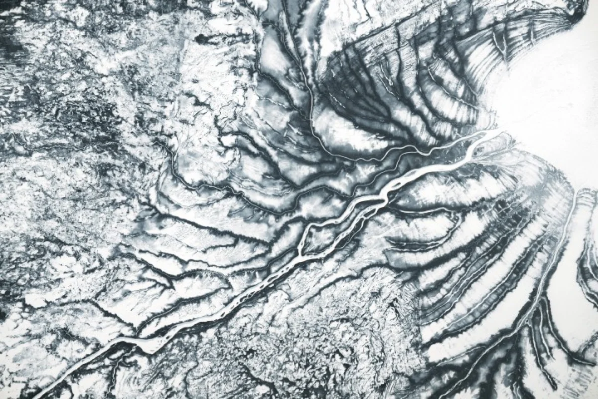
Recent observations highlighted by NASA Science confirm the continuous post-glacial rebound phenomenon in the James Bay Lowlands, following the retreat of the colossal Laurentide Ice Sheet. The land, once burdened by immense ice, is steadily rising, exposing intricate nearshore landforms and altering the region's coastal geography. This ongoing geological process provides valuable insights into Earth's crustal dynamics and long-term environmental transformation, underscoring the enduring legacy of ancient glaciations on modern landscapes.
Key Facts
-
Geological Phenomenon Post-glacial isostatic rebound
-
Primary Cause Retreat of the Laurentide Ice Sheet
-
Affected Region James Bay Lowlands, adjacent to Hudson Bay
-
Observed Outcome Striking and evolving nearshore topography
-
Observing Entity NASA Science
Impact
The continuous uplift in the James Bay Lowlands significantly impacts the region's delicate ecosystems and physical geography. As the land rises, it alters drainage patterns, exposes new land along the coast, and transforms existing wetlands and intertidal zones. This dynamic process directly influences habitats for migratory birds, marine life, and terrestrial species, leading to shifts in biodiversity and ecosystem services. Understanding these changes is crucial for ecological conservation and managing the unique natural heritage of the subarctic environment. From a scientific perspective, the visible changes offer a living laboratory for glaciology, geophysics, and climate science. Data gathered from such regions helps refine models of Earth's crustal deformation, viscoelastic properties, and the long-term effects of ice sheet melt. These insights are vital for predicting future land elevation changes in areas currently experiencing rapid ice loss, providing critical context for sea-level rise projections and coastal planning in other parts of the globe.
Key Insights
-
1
Geological Understanding
Provides real-world data for refining models of post-glacial rebound, Earth's mantle viscosity, and the interaction between ice sheets and lithospheric plates.
-
2
Climate Change Analog
Offers a historical and ongoing analog for understanding land response to present-day and future ice sheet melting and sea-level fluctuations.
-
3
Remote Sensing Value
Underscores the critical role of satellite-based remote sensing technologies in monitoring slow, large-scale geological processes and their environmental consequences over vast, remote areas.
Opportunities
The ongoing geological activity in the James Bay Lowlands presents several opportunities for technological advancement and specialized services. There is a growing demand for advanced remote sensing technologies, such as improved Synthetic Aperture Radar (InSAR) and gravimetry missions, capable of precisely measuring subtle changes in land elevation over extended periods. This drives innovation in satellite design, data processing algorithms, and geospatial analytics, offering avenues for tech companies and research institutions. Furthermore, the unique environmental dynamics create a need for expert environmental consulting and engineering services. Businesses specializing in coastal adaptation strategies, wetland restoration, and infrastructure planning in dynamic landscapes can find significant demand. This extends to developing sustainable resource management plans for Indigenous communities living in the region, ensuring their traditional territories and livelihoods are sustained amidst evolving conditions.
Risks & Challenges
The continuous land uplift poses potential risks to existing and planned infrastructure in the James Bay Lowlands. Coastal communities, transportation networks, and resource extraction operations (e.g., hydroelectric dams, mining) may face challenges from altered shorelines, changing water depths, and shifting hydrological regimes. Navigational routes could be impacted by newly revealed shoals or altered river mouths, necessitating constant monitoring and updating of charts. Ecologically, the dynamic landscape could disrupt sensitive habitats, affecting biodiversity and potentially impacting local Indigenous populations who rely on these ecosystems for sustenance and cultural practices. Changes in water flow and land exposure can alter fish spawning grounds, migratory bird stopovers, and the distribution of crucial plant species. Managing these ecological shifts requires careful planning and collaboration to mitigate adverse effects on both the natural environment and human communities.
Source url: https://science.nasa.gov/earth/earth-observatory/contours-of-the-james-bay-lowlands/